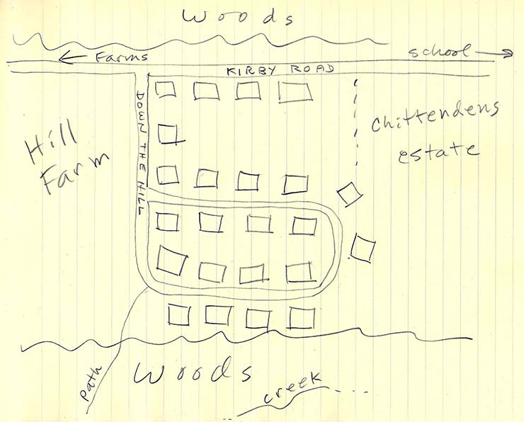
A map of the area as I remember it, 1947-56. "Down the Hill" is now called
Franklin Avenue, and it keeps going beyond the loop, which is now called
Patton Terrace and MacArthur Drive and now extends to the left and right.
I'm just guessing at the number and placement of the houses (there might
have been a few more), except along Kirby Road; I'm sure there were four, of
which ours was the second from the left. I'm not sure when the woods became
housing developments, or when the Hill and other farms disappeared, but the
area didn't change at all between 1947 and 1956. Further to the left
(southwest), however, the first big subdivision of brick houses had already
been built by about 1954 (west of the Hill Farm and on the other side of
Kirby Road). The path went through the woods to the other side coming out
on (I'm pretty sure it was) Rockingham Street.