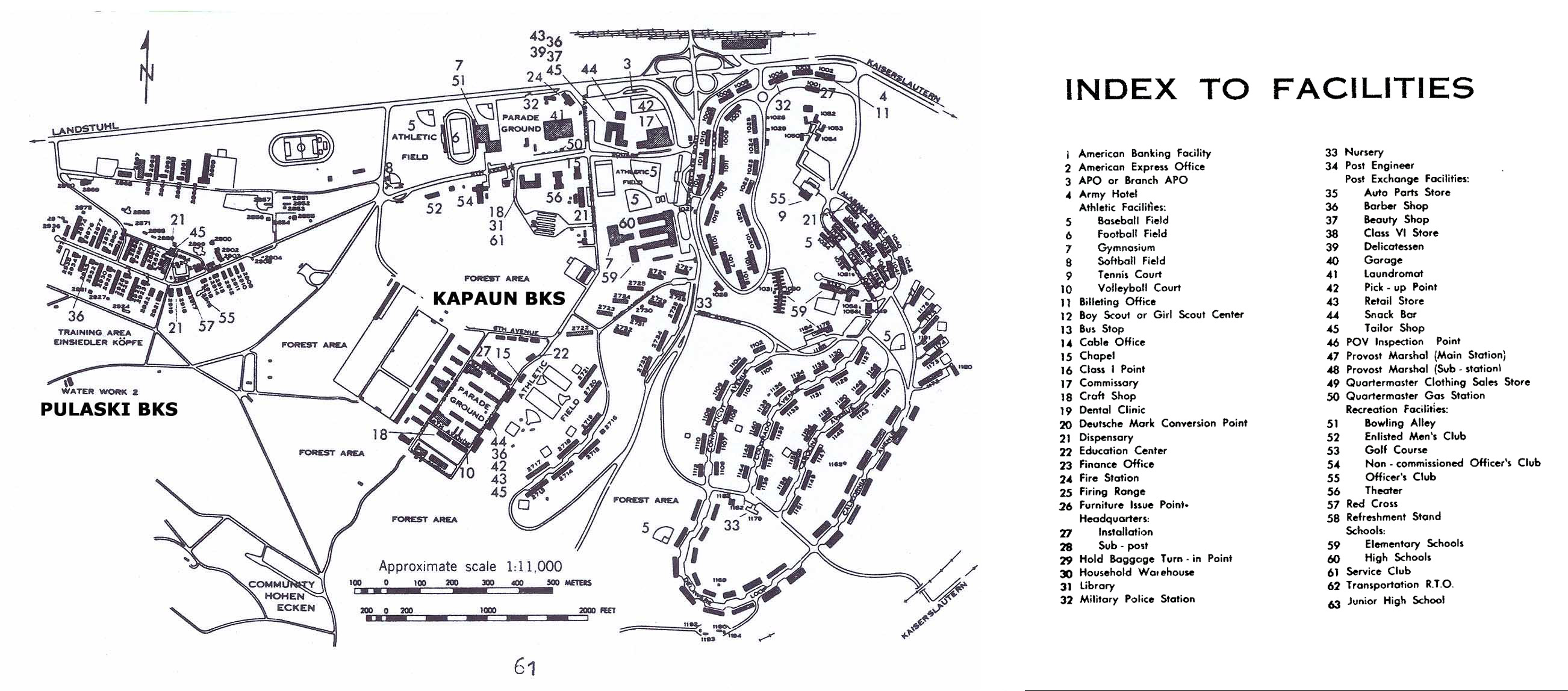
Image: US Military Installation Atlas, 37th Trans Gp, 1980,
via USArmyGermany.com
US Army Pulaski Barracks and Kapaun Barracks, Vogelweh, Kaiserslautern, late
1970s. Kapaun Kaserne (barracks) is just above the "Approximate scale"
legend, between 0 and 400 meters, comprising barracks buildings (living
quarters), the headquarters building of the 3rd Reconnaissance Squadron, and
the mess hall. To its immediate left, the motor pool. On the right edge of
the parade ground: small snack bar, barber, mini-PX, tailor, and chapel. To
the right are dependent family housing and Kaiserslautern high school (where
I took some University of Maryland extension night classes), junior high
school, and teen club. At the bottom, left of the scale, is the village of
Hohenecken. At the top, left of the cloverleaf intersection is the main
Army shopping area for all of Kaiserslautern (which had other Kaserne
besides this one: Kleber, Daenner, Panzer...) which includes the big PX, the
main commisary, the Army gas station, the movie theater, a beauty parlor, a
craft shop, a music center, a gym, an athletic field, a bowling alley, and
so on, plus the NCO and EM clubs and AFN Kaiserslautern; click on the image
to see the complete list. Coincidentally, Pam Ives lived in the housing
area in 1959-60 and attended the junior high school three years before I
lived there and a year before she moved to Frankfurt and I met her.

|
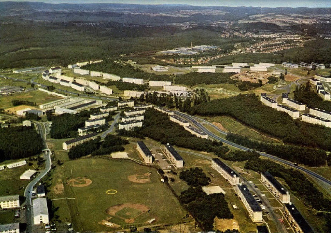
| Kapaun area aerial view 1964 - Click to enlarge |

|
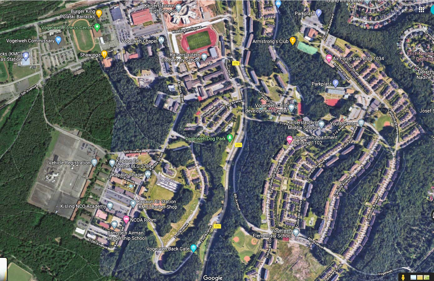
| Google aerial view 2009 - Click to enlarge |