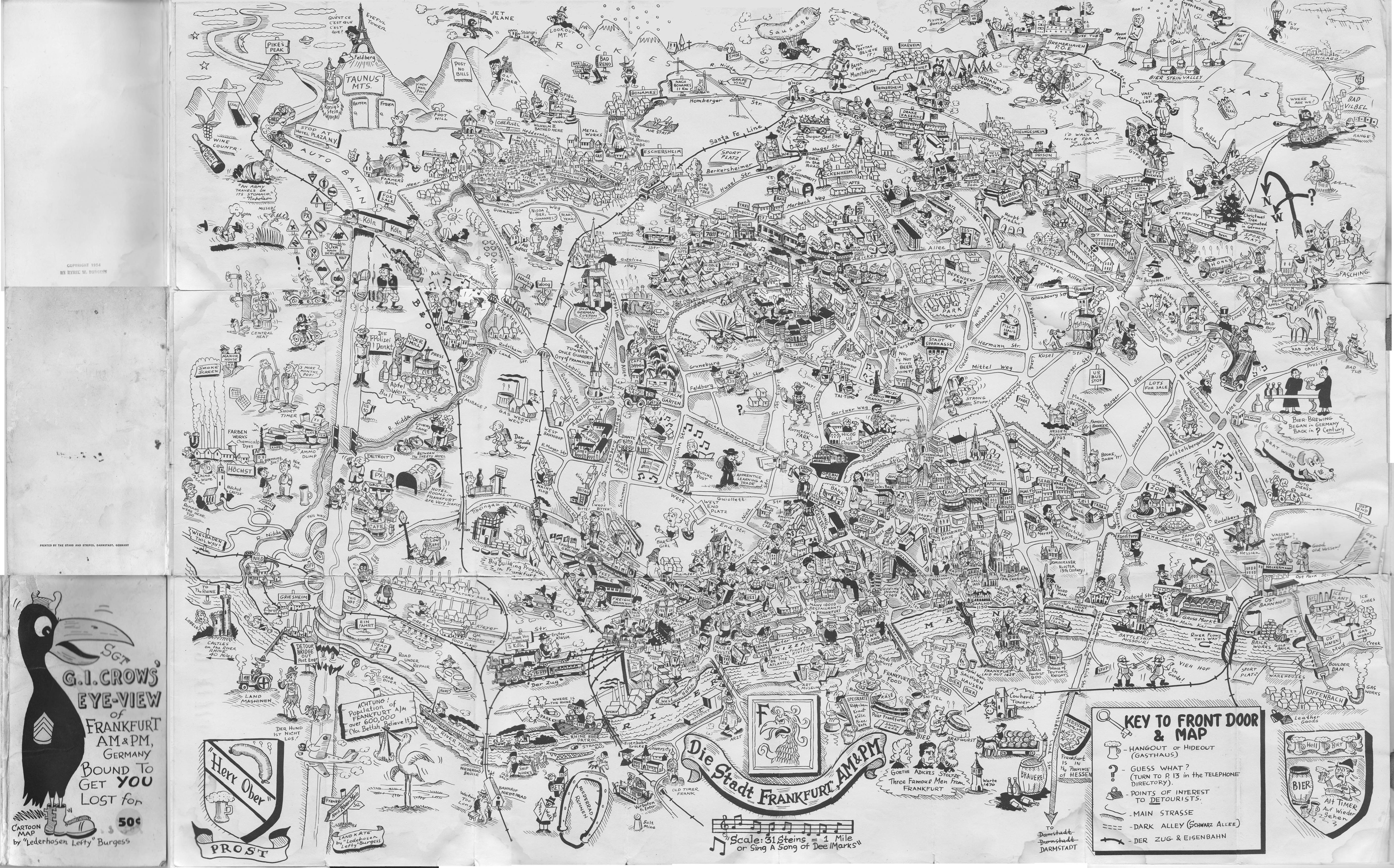
A jokey map of Frankfurt drawn by SSGT "Lederhosen Lefty" Burgess in 1954
with a lot of GI humor (e.g. it shows not only a HiCoG but also a MiddleCog
and a LowCoG). It includes an amazing amount of detail and I learned some
things from it; for example, did you ever wonder why the circle at the
intersection of Adickes Allee and Eschersheimer Landstraße was called WAC
Circle? Because a WAC barracks used
to be there. The map was printed by the Stars and Stripes and sold for
50¢.